LOUISVILLE, Ky. — Nothing extravagant has really changed from our forecast Wednesday into today. We’re still looking at several chances of rain and possibly a little snow through early next week with temperatures see-sawing between below average and normal.
Forecast at a glance:
- Filtered sunshine today will give way to increase clouds tonight
- Friday will be cloudy with scattered showers, mainly east of Louisville
- Saturday brings more on and off showers to Kentuckiana
- A brief break Sunday, but it will be colder
- Monday looks to bring rain and snow to the region – but it’s a very tricky forecast.
Weather setup: Thursday morning saw a low pressure system in portions of Iowa moving northeast into the Great Lakes. High clouds were filtering sunshine across portions of southern Indiana and central/southern Kentucky. South winds were helping to bring in warmer air to the south as high pressure to our north continued to move east. Moisture from the Gulf of Mexico will continue to be transported north Thursday night and Friday.
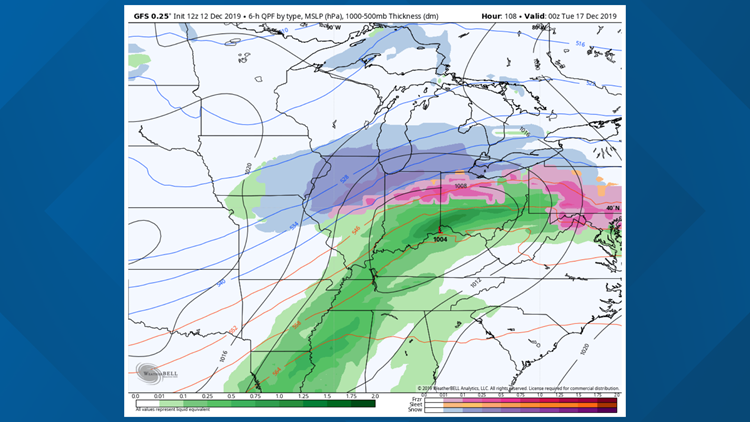
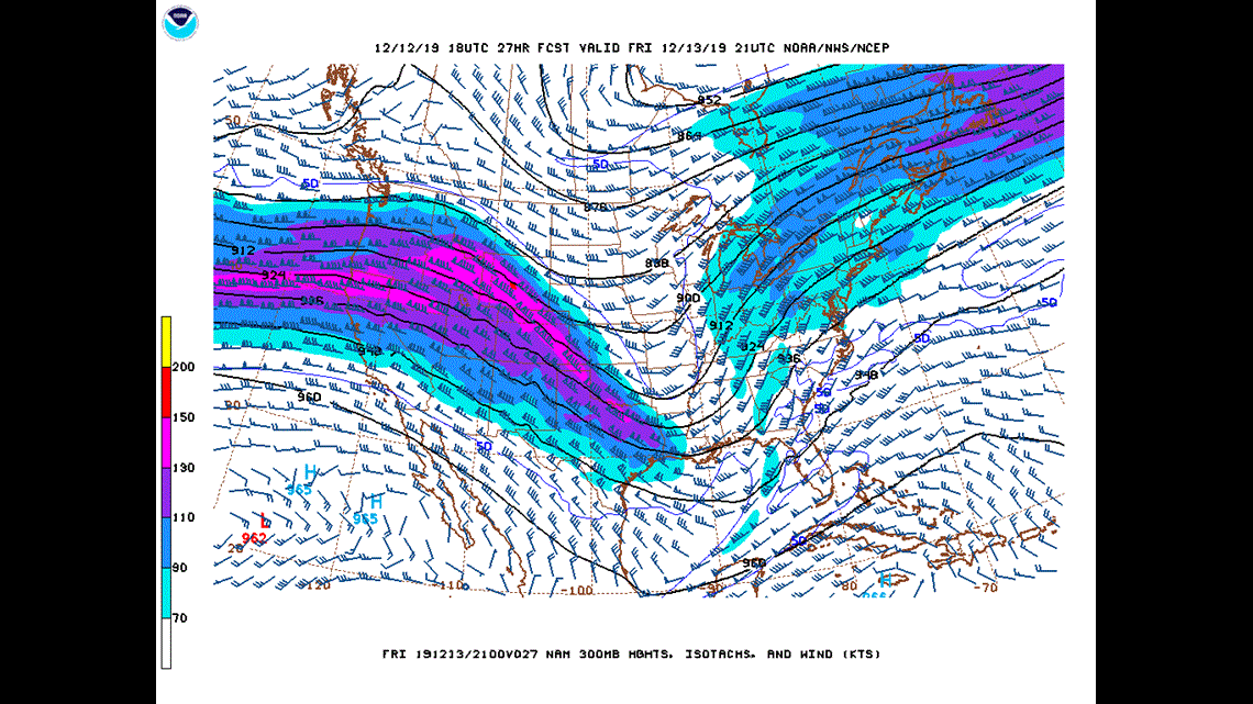
In the jet stream level (Figure 1) of the atmosphere we still note that wave that will be interacting with a disturbance in the Gulf of Mexico and provide a good amount of rain for Appalachia and the Atlantic Seaboard. Much of the WHAS11 viewing area will be on the western edge of this system and several of us likely won’t see anything more than and clouds and an occasional sprinkle. We’re still targeting locations south and east of Bluegrass Parkway as the most likely area to see scattered rain showers.

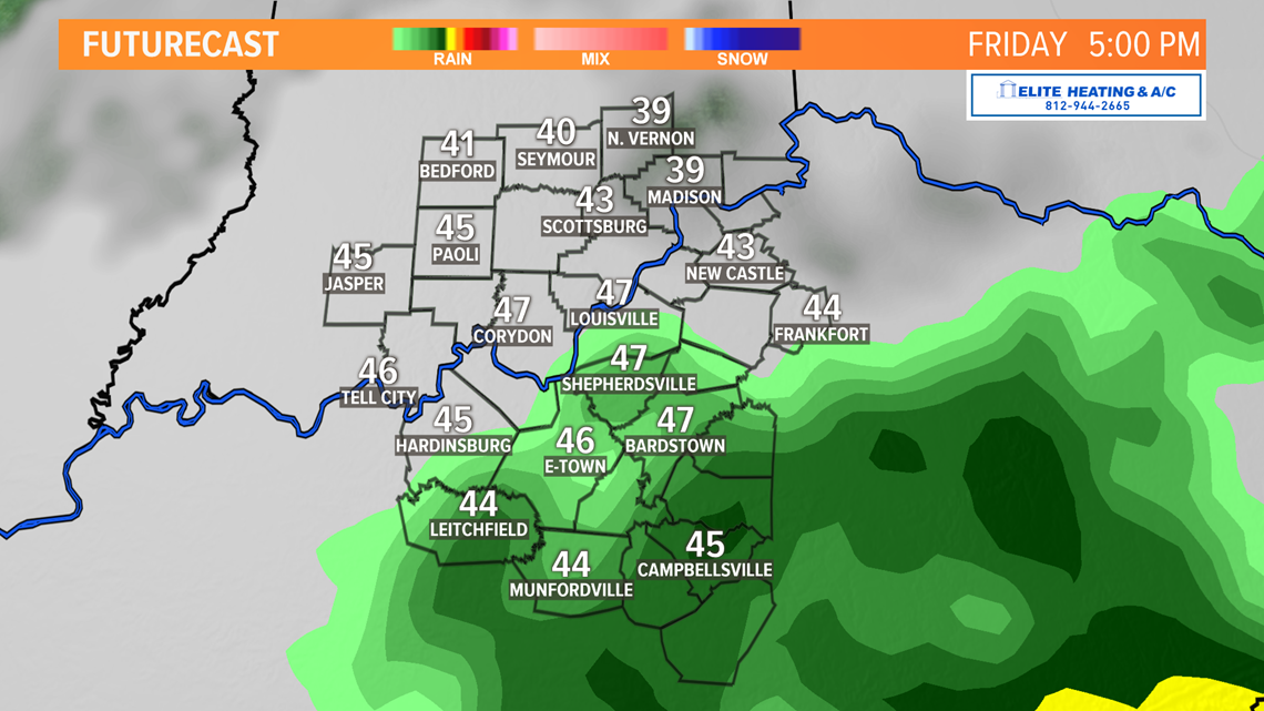
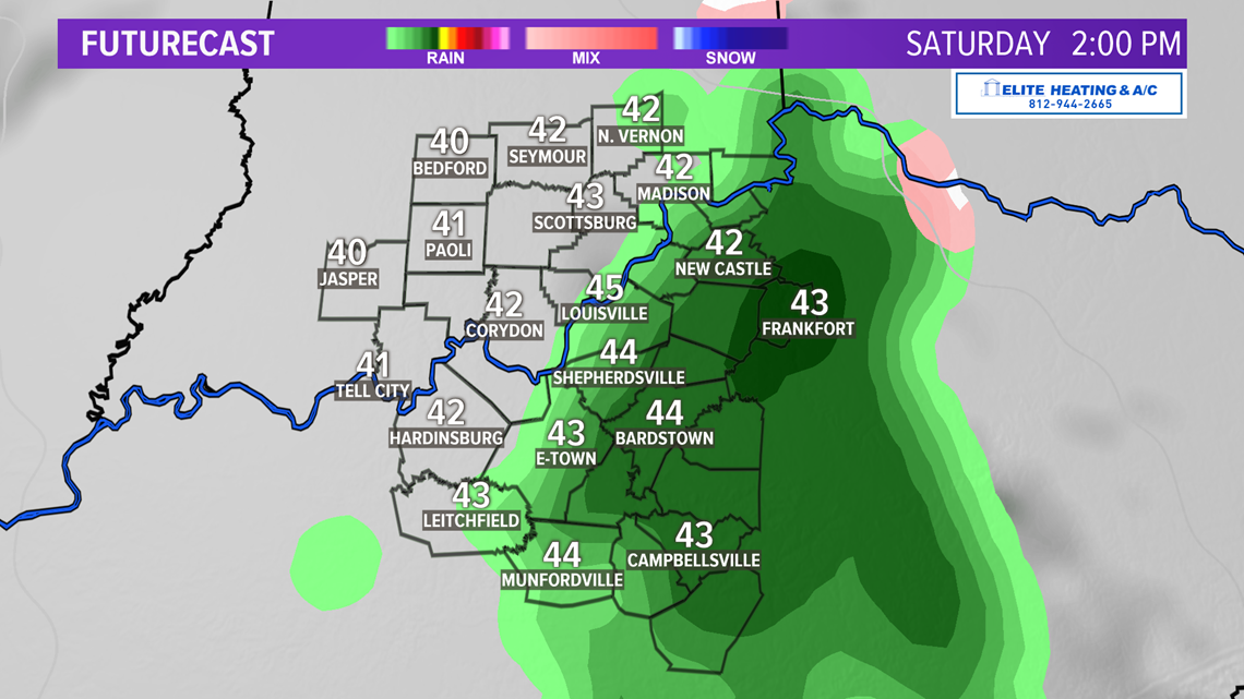
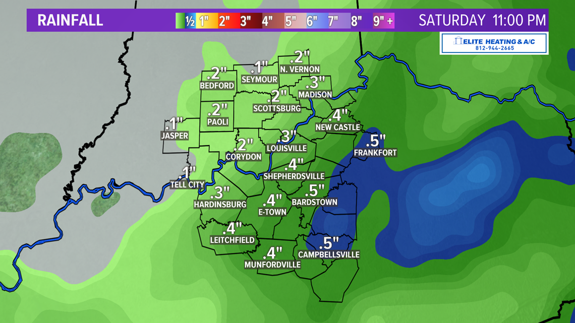
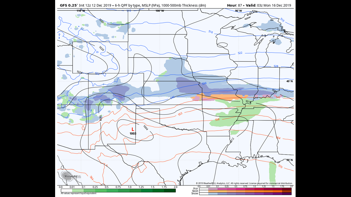
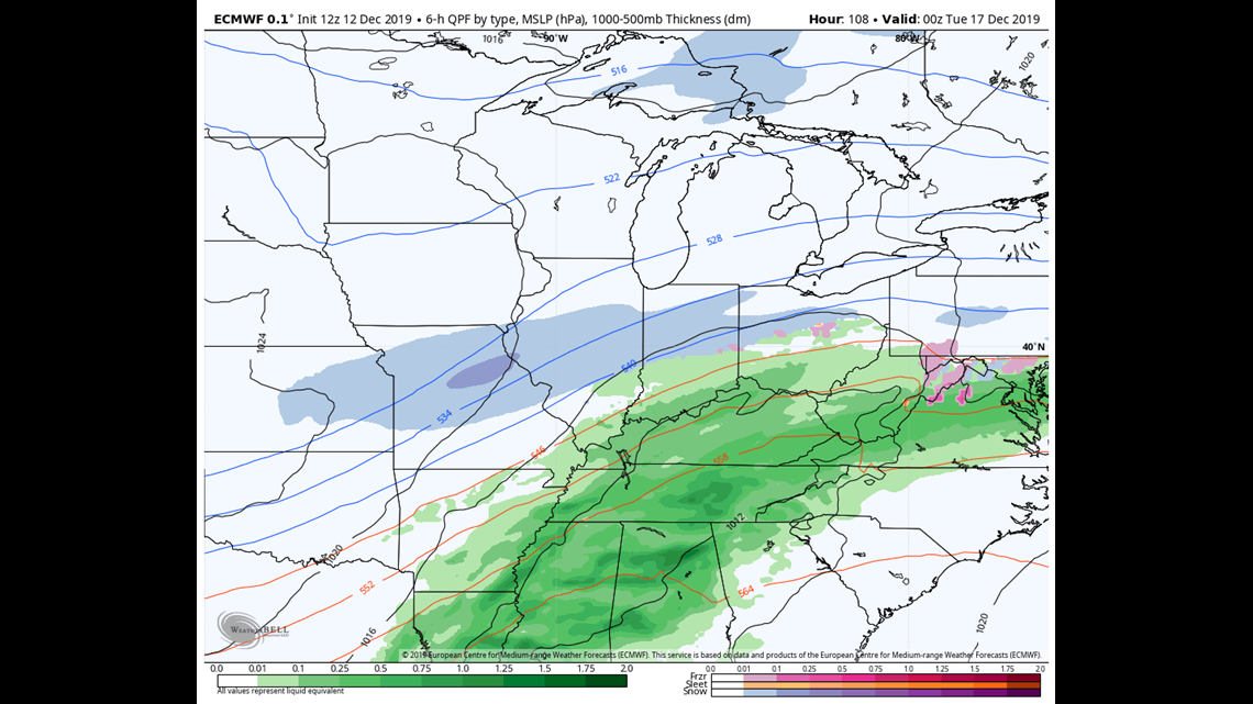
The rain will ramp up in coverage in east Kentucky Friday night into early Saturday morning after midnight (Figure 2). If your house missed out on the rain Friday, fear not, a second wave will swing by on Saturday and bring light rain from west-to-east middle Saturday morning through afternoon (Figure 3). Rainfall this weekend won’t be very impressive if you aren’t south of Bluegrass Parkway. Less than a quarter inch of rain is anticipated for much of the area north of the Parkway, but a quarter-to-half inch will be possible south of it (Figure 4).


Sunday is a brief intermission between acts. A zonal flow will result in calm weather to close the weekend. Another hefty jet streak will be overhead Sunday, but given its zonal nature, nothing will result from it. A broad trough will have formed by Sunday morning in the Pacific Northwest and will begin moving into the Plains later that night into early Monday morning. Now the forecast gets tricky.
The main event: Meteorologists will often say a storm four, five, or more days out has considerable uncertainty, and that’s true. There are times, however, where models can have a consensus on the overall pattern which helps give us a broad idea of what the weather will entail. On the other hand, models can present sometimes wildly opposing solutions four or five days out. The storm for Monday is somewhat in the middle: we’ve known for days that a storm will impact the Ohio Valley (consensus), but we’ve been lacking confidence in how that storm will play out (opposing solutions).
WHAT WE KNOW:
- A new storm will move through the Ohio Valley late Sunday and through Monday
- Rain will fall
- The Ohio Valley will see snow (but, perhaps not much in our viewing area)
- It will get unseasonably cold after Monday
WHAT WE DON’T KNOW
- The exact timing of the onset of precipitation
- With certainty how much rain (or potentially snow for that matter) will fall
- Where specifically in the Ohio Valley will that snow fall
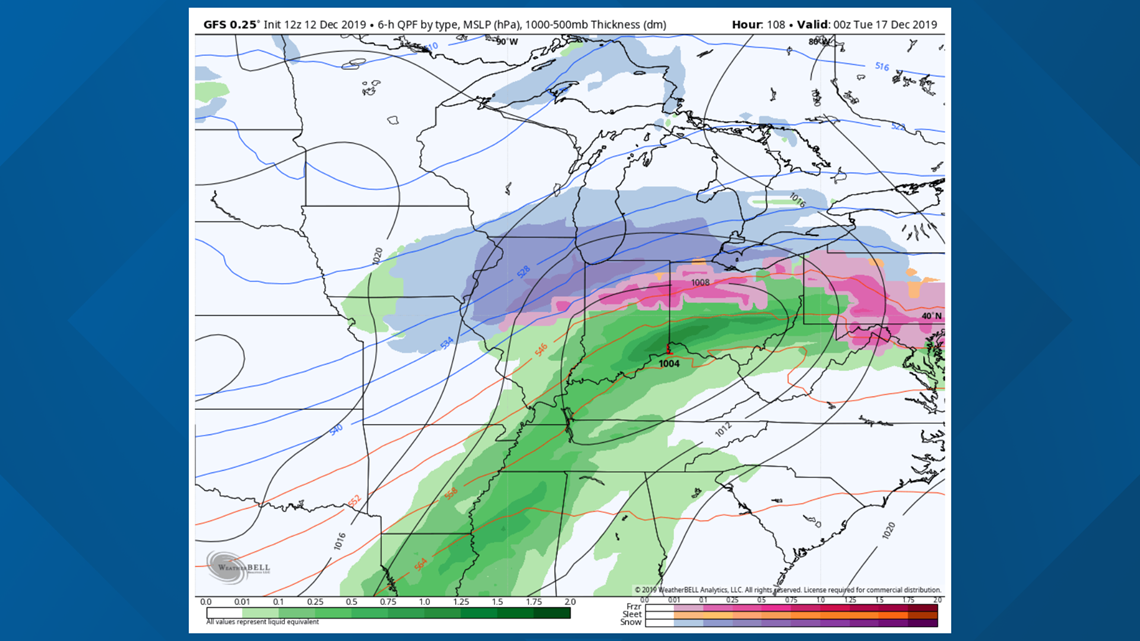
Let’s go through the differing model solutions, starting with the GFS. By Sunday night a lee cyclone will have developed deep in the southern Rockies in New Mexico. It will continue to sag south into central Texas before starting its journey north in the lower Mississippi River Valley early Monday and entering the Ohio River Valley Monday afternoon and evening. As it nears Sunday night, it develops a band of snow and mixed precipitation that would come to an end before sunrise Monday. After that, it’s a good amount of rain the rest of the day and into the night.

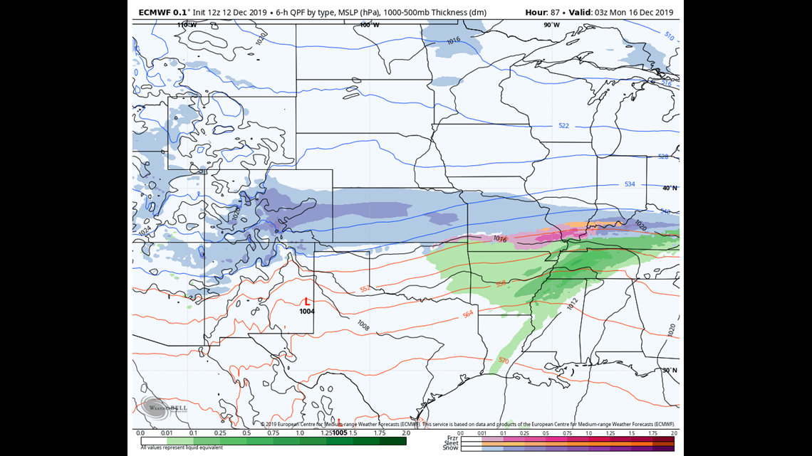
The European and Canadian models were initially very different, but as of Thursday morning appear to be coming into better agreement with the GFS. Wednesday it was very snowy, now, not so much. It also develops a lee cyclone over New Mexico Sunday afternoon. It doesn’t appear to be as organized as its GFS counterpart and instead morphs into a malformed lobe along a similar path to the GFS, except much further south. That southern track is critical. A more southerly track of the storm would mean more snow. Like the GFS, snow starts Sunday evening, ends by sunrise Monday, and then transitions to rain for the rest of the day.


Temperatures: This is going to be the limiting factor. The problem with these recent storms is that there hasn’t been enough cold air to support snow. The Monday storm looks to be the same. Temperatures aloft might be cold enough to allow for flakes, but near-surface temperatures will be so warm that a lot of it would melt on contact or as it falls. Lows Sunday night are at or above freezing, so that also doesn’t help.
While the Euro is…generous…with snow totals, the GFS gives us virtually nothing, and even if snow accumulated, it would melt quickly thanks to those above freezing temps and persistent rain afterward. We still will not show any snow totals. It’s just too far out and there’s still not enough certainty between them to confidently give amounts.
Meteorologist Alden German
Facebook: Facebook.com/AldenGermanWX | Twitter: @WXAlden