
LOUISVILLE, Ky. — Scattered showers and thunderstorms are possible after sunset. A few could be on the strong side with a slight chance for the storms to become severe. Storms will move west to east from 9pm-2am. The main threat is damaging wind gusts. Frequent lightning, heavy rain, and a quick spin up tornado are possible as well.
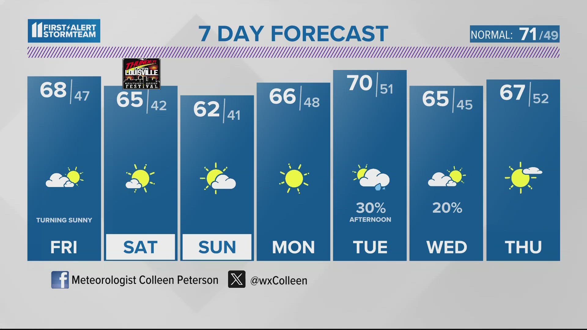
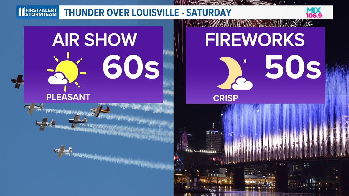
We are cooler behind the front and drop to the 60s Friday through Tuesday. Thunder Over Louisville weather looks great! Pleasant sunshine with highs in the middle 60s and light wind.

We remain dry to begin the new work week with our next chance for rain holding off until Tuesday.
Download the free WHAS11 app for the latest weather alerts from the First Alert StormTeam. For Apple or Android users.
FORECAST
TONIGHT: Showers and storms likely. A few storms may turn strong/severe. Low: 57°. Wind: S/NW 5-15 mph.
TOMORROW: Mostly cloudy early; Turning sunny for the afternoon. High: 68°. Wind: NW 5-15 mph.
SATURDAY: Pleasant and mostly sunny. High: 64°.
LIVE RADAR
Related video
More from the First Alert StormTeam


Follow the First Alert StormTeam on social media.
DOWNLOAD THE WHAS11 APP:
Download the free WHAS11 app for the latest weather alerts from the First Alert StormTeam. For Apple or Android users.
JOIN THE CLOUD WATCHERS FACEBOOK GROUP:
Interested in photography? Join nearly 8,000 residents from Kentucky and southern Indiana and share your weather photos. Click here to join the group!