
Typically, our summer pattern is kind of lazy, with hazy, hot, and humid conditions and a few pop-up storms now and again. However, today won't a normal summer set-up. In fact, this looks to be an anomalous July severe weather event where the environment looks to have more spring-like severe weather ingredients - featuring plenty of jet stream energy!
The combination of summer heat and humidity will provide a large amount of instability. Plus, the low-pressure system and strong wind fields will provide the potential for a round or two of strong to severe storms. The Storm Prediction Center has upgraded our area to a Moderate Risk of Severe Storms (Level 4 of 5) for Friday afternoon and evening. We typically only see this level of risk maybe a few times during our usual severe weather season just to give you some perspective. Notice the "bulls-eye" with the highest severe weather threat is right here in Kentuckiana!
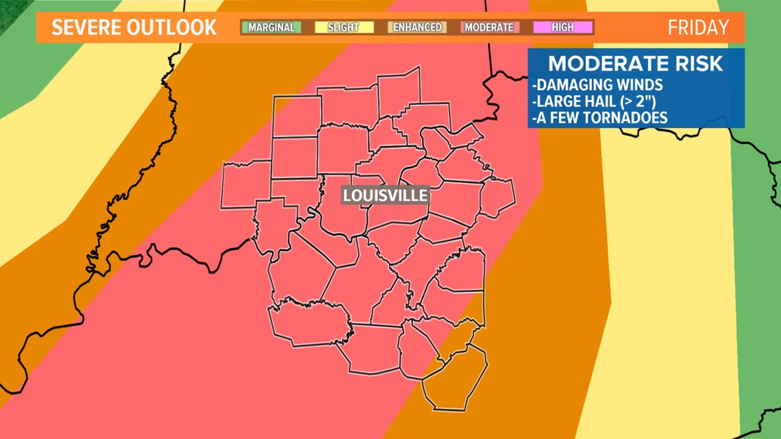
THREATS: All severe threats are on the table: Damaging wind, large hail, isolated tornado, localized flooding. One thing to note is that the reason for the upgrade to the "Moderate Risk" from the SPC is for the large hail potential. Damaging hail the size of golf balls or slightly larger may be possible with some the storms.
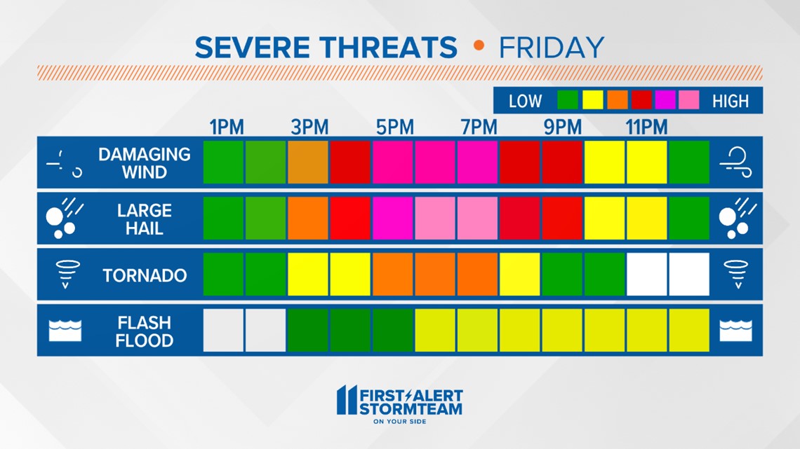
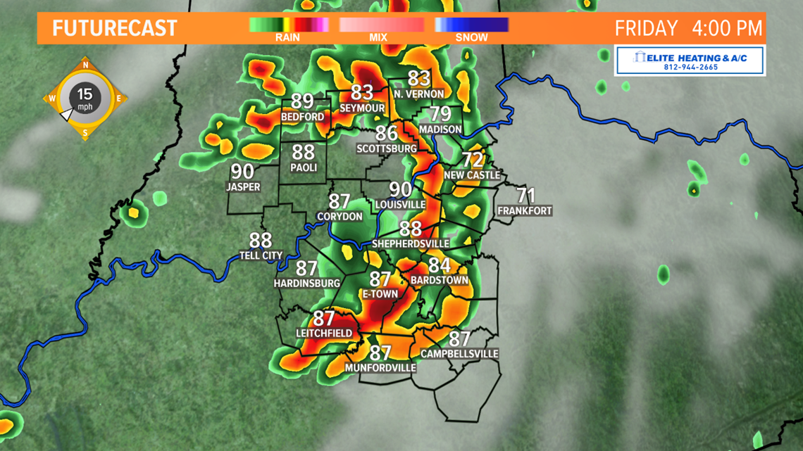
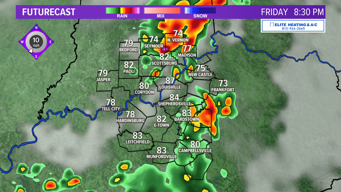
TIMING: Again, this afternoon and evening will likely be the focal point for the severe threat. Have your severe weather plan ready to go and be ready to seek shelter if a warning is issued. We hope the severe weather threat will diminish not long after sunset - however, the exact timing of the strongest storms is still subject to change. Stay tuned to the WHAS11 First Alert StormTeam for the latest updates!
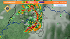
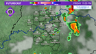
FUTURECAST:


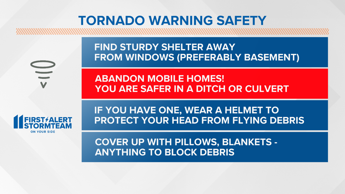
Remember, if a Severe Thunder Storm or Tornado Watch is issued - that means conditions are favorable for severe storms within the next few hours. A Warning means seek shelter immediately.

Follow Meteorologist T.G. Shuck on Facebook and Twitter for more severe weather updates: